In the background noise of the diving world, the constant hum persists of stories and rumors of lost ships and wrecks, and things the sea claimed for her own.
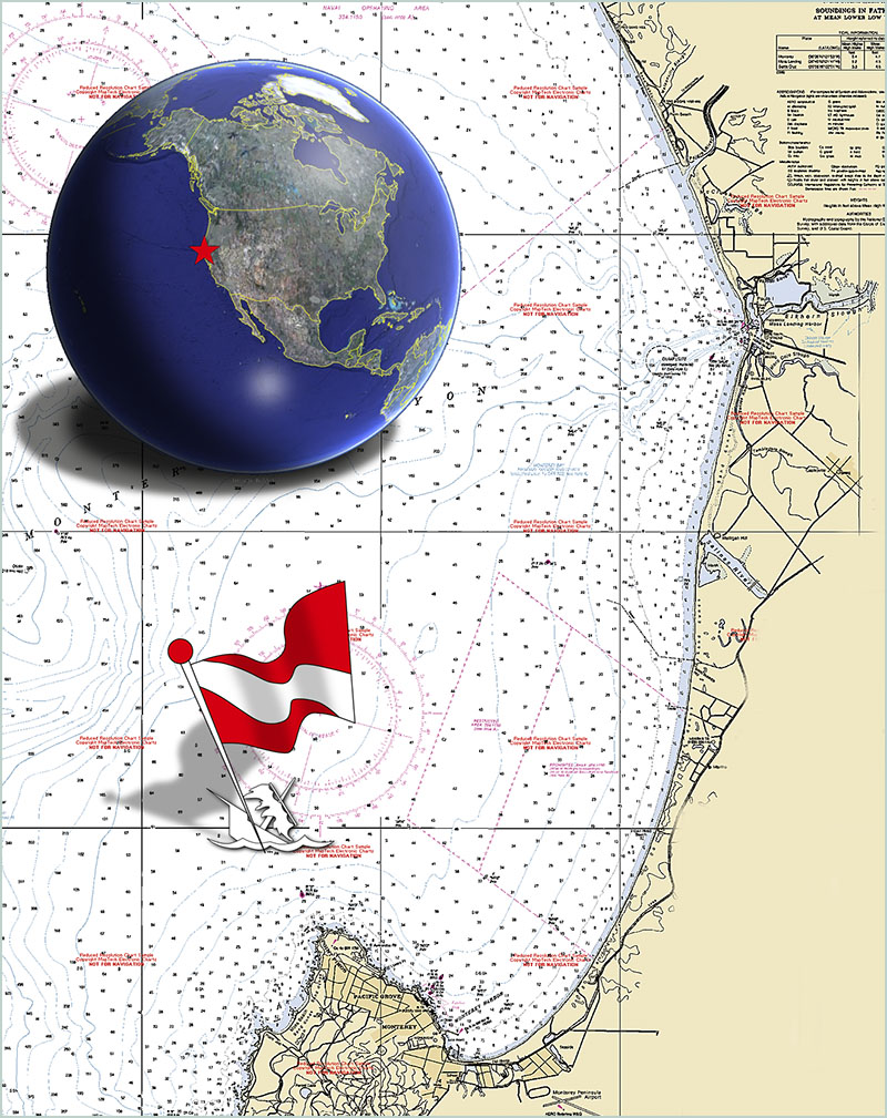
It is no different here in Monterey. But for a coastline littered with wrecks, California is not a mecca for wreck divers. Our coast lacks the warm, romantic, aquarium-blue waters of the Caribbean, the graveyard expanse of East Coast shipping lanes, the history and antiquities of the Mediterranean, the quiet calm of a Western Pacific lagoon.
The old Spanish and English tall ships that once sailed these waters are buried in time, and any that may have gone down here were ground into infinity by big, cold seas and perpetual shifting sands. There are carcasses of steel and wood smashed beyond recognition sitting off any point of land you choose. Anything the rocks and reefs don't pound to pieces, the abyss just swallows whole.
Still, if you asked around, there were faint rumors of some ship that had foundered off Point Piños. Somebody said it had broken up and been towed back out a few miles and left to sink. How long ago wasn't clear? Some said it had been salvaged. Others said it was a huge barge. Why it might have gone down, they couldn't really say.
Encouraged by more local rumors and sketchy memories of a ship or barge that had gone down sometime in the late 80s, our small group of sport divers set out in the spring of 2005 to search for what truth might be behind this veiled but inviting tale.
Captain Phil Sammet, local deep diver and boat guru, started our little adventure. Being someone who always keeps track of such lore, he mentioned in passing one day that he thought he had seen a wreck noted on an old NOAA chart, or at least a mark of something lying somewhere offshore of Point Piños.
Marcos Perreau Guimaraes, our ever-questioning Frenchman, began comparing the various maps and charts carefully for any unusual sign or mark. On just one edition of the NOAA charts, he finally found the map notation indicating an unnamed wreck, just as Phil had reported.
This minor glitch in documentation gave Marcos some encouragement that this might be something unexplored — something that might have been forgotten or overlooked by others. None of the newer charts had any marks or notes, or had shown any indications of any unnamed wreck for years.
Using detailed bathymetric maps recently available online, Marcos made a three-dimensional search of the topography of the area. (Bathymetric maps are slowly becoming part of everyday dive planning, and can show a diver a clear picture of the ocean floor within a few meters resolution.) Examining this data closely, a funny little blip showed plainly just off Point Piños, 500 yards from the NOAA designation. It was shaped just like a boat.
Marcos called Phil on the phone that evening, dangling the bait of a promising adventure. A few days later, on the way back from diving the deep pinnacles out of Point Lobos, Marcos casually mentioned to me that he thought he'd found something interesting. And, with one of his mischievous faraway looks, he added, "It may be manmade." Then, with Denzil Wessels, another buddy, the dive planning was soon a whirring discussion.
With all of us huddled over a computer, a little tweaking of the bathymetric software produced a three-dimensional projection of the seafloor map, generating a sketch of what the site might look like underwater. Clean lines, angles, and curves certainly didn't look like a natural formation. The spot we were looking at for our next dive was a sharp bump that came up to 265, sitting alone on the sand at a depth of 310 feet. That was deep; but conveniently, it was only a couple of miles offshore, and just a short boat ride from the harbor in Monterey.
Preliminary onsite verification was easy with our friend, Tom Mesch, his boat, and a simple depth finder. Just twenty feet in front of the exact GPS numbers provided by the USGS maps, running over flat sand, a clear spike came up, dropping away just as fast -- it was a narrow target, and a long way down.
Maybe this wreck is real.
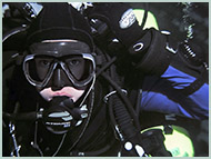
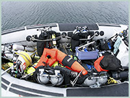
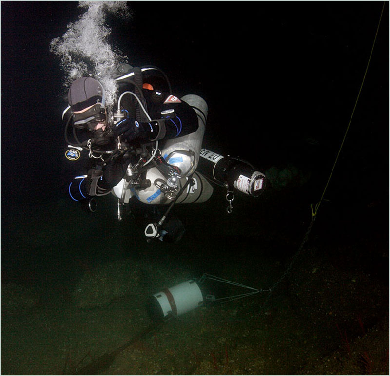
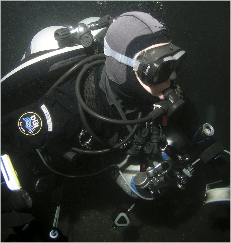
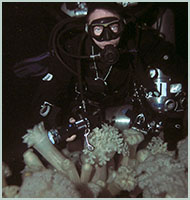
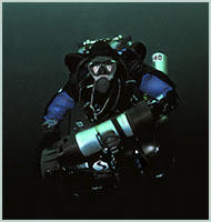
For our first dive in this mystery spot, we needed to keep it as simple as possible using open circuit scuba. This also meant a "quick" dive with a planned bottom time of only 15 minutes. We would be carrying all of our breathing gas with us throughout the entire dive -- back gas, travel mix, EAN 50, and oxygen.
Exposed to offshore conditions, we would need to rely on our experience in diving in remote locations, and pick ideal days for weather and times of dead slack tide. We waited a few months for the perfect day.
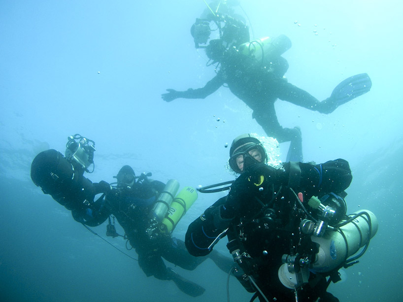
We launched from the Breakwater. Losing sight of Pacific Grove and points south in the lingering coastline fog, we quietly motored out into sunny skies opening to glassy seas and slowly cycling swells. Near our spot, we cut the engines and drifted, all eyes fixed on the depth finder.
We idled in circles for some time, getting a sense of things down there. Marcos and Phil quietly discussed the readings on the depth finder. We were over a solid bottom at 300-plus. There were intermittent spikes to 265, eerie scattered images, then a sharp drop back to 305, 310, 300. We dropped our marker line and geared up.
Phil went on again about more rumors and stories about this huge barge being towed in during a storm. They said it filled with water and went down so fast that it nearly sank the tow vessel. A team of salvage divers was called in to make an attempt at recovery. The story goes that this expensive A-Team of professionals said it was undiveable. He thought tethered hardhat divers had been lowered on a platform and complained the currents were ripping so hard they wouldn't take the chance. The idea of a platform full of divers blown off a site 300 feet down into black nowhere seemed blood curdling.
Our drop line was running down, straight and clean. We might be lucky. And we weren't getting paid.
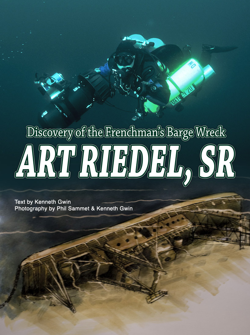
Following Denzil (always make the kid go first) and Marcos, I dropped through their clouds of bubbles, followed the line down past rings and spirals of endlessly long siphonophores, solitary small comb jellies, ghost-like leucothea. Below the layer thick with jellyfish, it was clear blue water.
Quickly losing daylight, we penetrated the still sunless depths. All I could see now were the shiny reflections off the tanks below me, and the waving explorations of their lights probing the darkness.
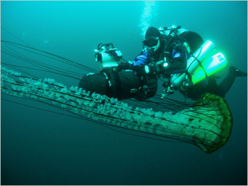
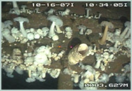
Then, below us and to the left, the distinct outline of a pattern of giant white metridiums came into view.
This was a structure.
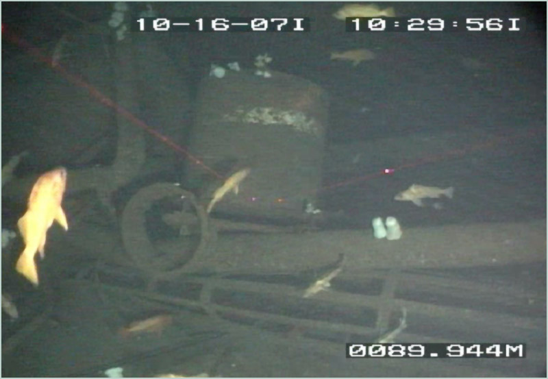
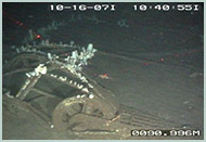
Past 300 feet, we hit the bottom. It only took a second to realize that this was the barge. Lying over on its side, its guts and derrick structure spilled out in a heap across the ocean floor. The wreckage had created a giant steel clamshell filled with goodies hidden inside. Tools, shackles, and metal girders lay in tangled disarray. A huge anchor, awash in spotlights, was outlined below.
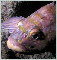
Easing gently along with our new discovery, we peered inside the ruins. We found a healthy population of big canary and copper rockfish swimming within the protection of cavernous walls and twisted girders. Fat vermilion rockfish paced slowly between encrusted columns and eyed us from the safety of deep shelter.
We only got a glimpse and our time was quickly gone.
Phil met with Scott Kathey at NOAA and the National Marine Sanctuary offices in Monterey, trying to find out more about the history of this barge. Scott happily pointed to the detailed shipwreck database maintained by Robert Schwemmer
Documents showed our barge was built for the U.S, Navy by the Pointer Willamette Company in Edmonds, Washington, and launched in July 1943. It was built as a 165-foot long, 923-ton diesel-electric hydraulic dredging barge, and designated the BD-1066. It was sent on its first work assignment to the Wrangle Narrows of Alaska.
It was rebuilt in 1950, increased in length to 236 feet and re-named the H.W. McCurdy. It now weighed in at 1200 tons with 6000 horsepower. With a crew of 35, running night and day, this complex of machinery was the largest privately operated hydraulic dredge of its kind, and was capable of pumping material two miles through a two-foot diameter pipe.
Sold again in the mid-sixties, and again in 1980, it was finally re-christened the Art Riedel, Sr.
Digging deeper, Phil reached the last owner of our mystery barge, Art Riedel, Jr., of Riedel International. He was amazed that anyone would actually find it or would even be interested. He recalled its colorful history, describing service as far afield as Kwajalein Island in the Western Pacific.
Its last assignment was working on the docks near the Queen Mary in Long Beach. It was being towed north on its way to the delta town of Rio Vista, on the Sacramento River when it ran into rough seas off Point Sur. Traveling light, top heavy, and unstable, it pitched easily, tossed from side to side, and began to take on water. A distress call went out as it was towed toward Monterey, closer to shore and into shallow water. It went down just before midnight on Tuesday, October 16, 1990.
Nobody died.
After a number of dives, we were able to explore the hull side, the corners at both ends, and the area around the house-like superstructure. We have noted a prolific number of juvenile and adult rockfish living on the site. We have observed schools of half-banded, rosy, and yelloweye rockfish, as well as wolf eels, lingcod, and other deep and cold-water fish. But, hidden among the white metridiums, we were most surprised to find scores of giant white vase sponges. Although not rare locally in depths past 200 feet, these sprouted in strange and bizarre shapes, growing to exceptional sizes through the broken rigging, gantries, and catwalks.
All of this growth and life has accumulated since 1990, when the Frenchman's Barge (as we like to call it) went down. This clarifies the amazing growth rate of these sponges as deep-water currents sweeping across the bottom of Monterey Bay bring in rich sources of food.
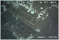
In the summer and fall of 2007, NOAA and a research team from the National Marine Fisheries Service made a submarine survey in the area following our discovery. They made three complete circular passes at three separate depths around the wreck. They noted that the structure was crumpled but intact and confined to one location (producing no significant debris field). The Frenchman's Barge will remain a rich monitoring site for future studies of deep-water habitat (especially for rockfish) and artificial reefs.